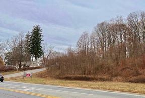
- For Sale Subject To Offer
- Property Type VacantLand
- Lot Size 0 Acre
- Date Updated Feb 20, 2025
Reach out to the broker for more info on lease terms and amenities
False
Contacts
Location
Getting Around
-
Walk Score ®
39/100 Car-Dependent
-
Bike Score ®
21/100 Somewhat Bikeable
- City Brewster, NY
- Neighborhood Brewster
- Zip Code 10509
- Market White Plains
Points of Interest
-
Croton Falls
4.79 miles
-
Purdy's
5.95 miles
-
Shell
0.54 miles
-
Mobil
1.77 miles
-
CITGO
1.84 miles
-
BP
2.09 miles
-
Hess
2.12 miles
-
Exxon
4.68 miles
-
WEC Fuel Pumps
6.72 miles
-
Wells Park
0.71 miles
-
Brewster Trailhead
1.88 miles
-
Route 6 @ Tilly Foster Road
2.29 miles
-
I-84 Exit 65 (Old Exit 19) Park & Ride
2.30 miles
-
orange trail
2.31 miles
-
yellow trail
2.44 miles
-
Rest Area Parking I-684 (North Bound)
2.99 miles
-
Clough Preserve Trailhead
3.21 miles
-
Putnam Trailway
4.03 miles
-
Fred Dill Wildlife Sanctuary
4.30 miles
-
Henry Van Motel
0.22 miles
-
Heidi's Inn
1.12 miles
-
Comfort Inn
1.27 miles
-
Bel Air Motor Lodge
2.17 miles
-
Patterson Inn
6.66 miles
-
Frank Lloyd Wright Model House
7.26 miles
-
Budget Motel
8.60 miles
-
Dunkin’
0.48 miles
-
Bob's Diner
1.07 miles
-
Burger King
1.93 miles
-
Eveready Diner
2.14 miles
-
Red Rooster
2.14 miles
-
Gaetano Pizza & Cafe
2.15 miles
-
Dunkin'
2.24 miles
-
Applebee's
2.27 miles
-
McDonald's
2.38 miles
-
Jiapore
3.13 miles
-
Saint Lawrence O'Toole School
0.87 miles
-
Henry H. Wells Middle School
2.51 miles
-
C.V. Starr Intermediate School
2.58 miles
-
John F. Kennedy Elementary School
2.83 miles
-
North Salem Central High School - Middle School
3.02 miles
-
Pequenakonck Elementary School
3.50 miles
-
Hillside Outdoor Education Center
3.72 miles
-
George Fischer Middle School
4.00 miles
-
Carmel High School
4.35 miles
-
Saint James the Apostle School
4.43 miles
-
Creative Kids Childcare Center
1.90 miles
-
Primrose School
8.59 miles
-
Learning Garden Daycare
9.69 miles
Looking for more in-depth information on this property? Find property characteristics, ownership, tenant details, local market insights and more. Unlock data on CommercialEdge.

Princeton Realty Group

