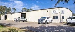
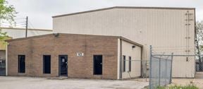
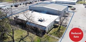
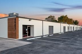
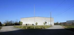
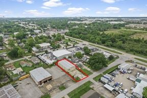
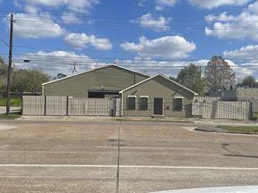
- For Sale Contact for pricing
- Property Type Industrial
- Property Size 45,000 SF
- Lot Size 1.03 Acre
- Year Built 1980
- Date Updated Apr 26, 2024
Want more info on this listing?
Reach out to the broker for more info on lease terms and amenities
False
Contacts
Location
Getting Around
-
Walk Score ®
80/100 Very Walkable
-
Transit Score ®
45/100 Some Transit
-
Bike Score ®
53/100 Bikeable
- City Houston, TX
- Neighborhood Washington Ave - Memorial Park
- Zip Code 77007
- Market Houston
Points of Interest
-
Houston
2.72 miles
-
Theater District (eastbound)
2.84 miles
-
Theater District (westbound)
2.91 miles
-
Quitman/Near Northside
2.93 miles
-
Downtown Transit Center
3.03 miles
-
Bell
3.04 miles
-
McGowen
3.05 miles
-
Main Street Square (southbound)
3.07 miles
-
Main Street Square (northbound)
3.09 miles
-
Central Station Main
3.12 miles
-
Exxon
0.17 miles
-
Valero
0.23 miles
-
Shell
0.30 miles
-
Texaco
0.37 miles
-
Exxon
0.41 miles
-
Shell
0.50 miles
-
Shell
0.62 miles
-
Chevron
0.97 miles
-
Shell
1.02 miles
-
Valero
1.03 miles
-
AIG Parking lot
1.40 miles
-
Bayou Greenways Park Trailhead & Parking
1.51 miles
-
Lot H
2.44 miles
-
Northwest Transit Center Parking
2.57 miles
-
Menil Collection parking
2.64 miles
-
Moran Center Parking Garage
2.73 miles
-
University Parking Lot
2.77 miles
-
Hyatt Regency Hotel Parking Garage
2.82 miles
-
Hyatt Regency Hotel Parking Garage
2.83 miles
-
1311 Louisiana St Garage
2.89 miles
-
Uberrito Mexican Grill
0.08 miles
-
Cyclone Anaya's Mexican Kitchen
0.13 miles
-
Lupe Tortilla
0.14 miles
-
Samurai Noodle
0.14 miles
-
Golden Hunan
0.14 miles
-
Jax Grill
0.15 miles
-
Pizzitola's
0.16 miles
-
Tacos Tierra Caliente
0.17 miles
-
Pluckers
0.18 miles
-
Cadillac Bar
0.22 miles
-
Walmart Supercenter
0.67 miles
-
Sprouts Farmers Market
0.71 miles
-
Big Lots
0.90 miles
-
H-E-B
1.01 miles
-
Heights Mercantile
1.04 miles
-
Kroger
1.04 miles
-
Kroger
1.34 miles
-
Whole Foods Market
1.45 miles
-
Kroger
1.47 miles
-
Target
1.61 miles
-
Men's T Clinic
0.14 miles
-
Woman's Health
0.31 miles
-
Houston Fire Department Station 11
0.47 miles
-
Walgreens
0.57 miles
-
Walmart Pharmacy
0.67 miles
-
Memorial Heights Emergency Center
0.70 miles
-
Houston Police Department - Heights
0.79 miles
-
Doctors Express Urgent Care
0.80 miles
-
Entrust Immediate Care
0.99 miles
-
H-E-B Pharmacy
1.01 miles
Frequently Asked Questions
What is the total square footage of 45,000 SF of Land?
45,000 SF of Land totals 45,000 square feet.
When was this property built?
45,000 SF of Land was built in 1980.
Looking for more in-depth information on this property?
Looking for more in-depth information on this property? Find property characteristics, ownership, tenant details, local market insights and more. Unlock data on CommercialEdge.

