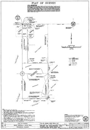
- For Lease Contact for pricing
- Property Type VacantLand
- Property Size 9,104,040 SF
- Lot Size 209 Acre
- Building Class C
- Year Built 2004
- Date Updated May 15, 2023
Want more info on this listing?
Reach out to the broker for more info on lease terms and amenities
False
Location
Getting Around
-
Walk Score ®
11/100 Car-Dependent
-
Bike Score ®
28/100 Somewhat Bikeable
- City Woodstock, IL
- Neighborhood Greenwood
- Zip Code 60098
- Market Chicago
Points of Interest
-
Woodstock
2.46 miles
-
East Union Depot
8.78 miles
-
Depot Avenue
8.79 miles
-
Electric Park
8.82 miles
-
Central Avenue
8.87 miles
-
Barn 9
8.93 miles
-
Harvard
8.99 miles
-
Springfield Avenue
9.03 miles
-
McHenry
9.91 miles
-
Kelley's Market (Mobil)
2.03 miles
-
Shell
2.52 miles
-
Shell
2.83 miles
-
BP
3.09 miles
-
Citgo
3.22 miles
-
Casey's General Store
4.22 miles
-
Mobil
4.30 miles
-
BP
8.74 miles
-
Marathon
9.20 miles
-
Marathon
9.37 miles
-
Metra Woodstock Throop Street Lot
2.44 miles
-
Woodstock Library Auxiliary Parking Lot
2.46 miles
-
Lot A
7.98 miles
-
Lot F
7.98 miles
-
Lot C
8.02 miles
-
Lot B
8.12 miles
-
Lot D
8.16 miles
-
Hebron Trail trailhead @ Seeman Road
9.14 miles
-
H.U.M. trailhead
9.54 miles
-
@ Petersen Park Beach
9.65 miles
-
Bundling Board Inn
2.79 miles
-
Best Western Woodstock Inn
3.64 miles
-
Quality Inn
4.14 miles
-
Super 8
4.24 miles
-
Crane Hollow Bed and Breakfast
6.92 miles
-
Ravenstone Castle
7.99 miles
-
The Heritage Inn & Suites
8.00 miles
-
Hampton Inn McHenry
9.96 miles
-
El Niagara
2.28 miles
-
Dairy Queen
2.32 miles
-
Public House
2.58 miles
-
Scoops
2.61 miles
-
Stage Left Cafe
2.64 miles
-
BBQ King
2.69 miles
-
Wendy's
2.81 miles
-
Little Caesars
2.90 miles
-
Panera Bread
3.02 miles
-
McDonald's
3.04 miles
-
Mary Endres School
1.23 miles
-
Northwood Junior High School
1.40 miles
-
Early Learning Center
1.45 miles
-
Clay Street Elementary School
2.26 miles
-
Saint Marys School
2.37 miles
-
Marian Central Catholic High School
2.51 miles
-
Woodstock High School
2.71 miles
-
Westwood Elementary School
3.13 miles
-
Creekside Middle School
5.02 miles
-
Prairiewood Elementary School
5.06 miles
-
McHenry Montessori School
8.69 miles
-
Nature's Scholars
9.67 miles
Frequently Asked Questions
What is the total square footage of Lamb Rd?
Lamb Rd totals 209 square feet.
When was this property built?
Lamb Rd was built in 2004.
Looking for more in-depth information on this property?
Looking for more in-depth information on this property? Find property characteristics, ownership, tenant details, local market insights and more. Unlock data on CommercialEdge.

